May
Highest water level (cm) | Maximum water level difference (cm) | |||||
Luong Phuc | Manh Tan | Phuc Loc Phuong | ||||
LP 2 -MT 3 | LP-PLP 4 | MT-PLP | ||||
VIII-2009 | 295 | 303 | 281 | -8 | 14 | 22 |
IX-2009 | 207 | 223 | 215 | -16 | -8 | 8 |
VII-2010 | 422 | 494 | 461 | -73 | -40 | 33 |
VIII-2010 | 422 | 511 | 471 | -90 | -50 | 40 |
IX-2010 | 369 | 398 | 332 | -29 | 37 | 66 |
VII-2011 | 350 | 365.5 | 279 | -16 | 71 | 87 |
VIII-2011 | 246 | 343.5 | 280 | -98 | -34 | 64 |
IX-2011 | 236 | 340.5 | 254 | -105 | -18 | 87 |
Maybe you are interested!
-
 Car body electrical practice - 8
zt2i3t4l5ee
zt2a3gs
zt2a3ge
zc2o3n4t5e6n7ts
If the voltage is out of specification, replace the wire or connector.
If the voltage is within specification, install the front fog light relay and follow step 5.
Step 5 Check the front fog light switch
- Remove the D4 connector of the fog light switch
- Use a multimeter to measure the resistance of the front fog light switch.
Measurement location
Condition
Standard
D4-3 (BFG) -D4-4 (LFG)
Light switchFront Fog OFF
>10kΩ
D4-3 (BFG) -D4-4 (LFG)
Front fog light switchON
<1 Ω
- Standard resistor
D4 connector is located on the combination switch assembly.
If the resistance is out of specification, replace the combination switch (the fog light switch is located in the combination switch).
If the resistance is within specification, follow step 6.
Step 6 Check wiring and connectors (front fog light relay-light selector switch)
- Disconnect connector D4 of the combination switch assembly
- Use a voltmeter to measure the voltage value of jack D4 on the wire side.
Measurement location
Control modecontrol
Standard
D4-3 (BFG) - (-) AQ
TAIL
11 to 14 V
D4 connector for the wiring of the combination switch assembly
If the voltage does not meet the standard, replace the wire or connector.
If the voltage is within standard, there may have been an error in the previous measurements.
Step 7 Check the front fog lights
- Remove the front fog light electrical connector.
- Supply battery voltage to the fog lamp terminals
Jack 8, B9 of front fog lamp on the electrical side
blind first.
Power supply location
Terms and Conditions
Battery positive terminal - Terminal 2Battery negative terminal - Terminal 1
Fog lightsbefore morning
- If the light does not come on, replace the bulb.
If the light is on, re-plug the jack and continue to step 8.
Step 8 Check wiring and connectors (relay and front fog lights)
- Disconnect the B8 and B9 connectors of the front fog lights.
- Use a voltmeter to measure voltage at the following locations:
Measurement location
Switch location
Terms and Conditions
B8-2 - (-) AQ
Electric lock ON TAIL size switchFog switch ON
11 to 14 V
B9-2 - (-) AQ
Electric lock ONTAIL size switch Fog switch ON
11 to 14 V
B8 and B9 connectors on the front fog lamp wiring side
Voltage is not up to standard, repair or replace the jack. If up to standard, there may have been an error in the measurement process.
2.2.4. Procedure for removing, installing and adjusting fog lights 1. Procedure for removing
- Remove the front inner ear pads
Use a screwdriver to remove the 3 screws and remove the front part of the front inner ear liner
-Remove the fog light assembly
+ Disconnect the connector.
+ Use a screwdriver to remove 3 screws to remove the fog light cover
2. Installation sequence
-Rotate the fog lamp bulb in the direction indicated by the arrow as shown in the figure and remove the fog lamp from the fog lamp assembly.
-Rotate the fog light bulb in the direction indicated by the arrow as shown in the figure and install the light into the fog light assembly.
- Use a screwdriver to install the fog light cover
-Install the electrical connector
Attention: Be careful not to damage the plastic thread on the lamp assembly.
- Install the front inner ear pads
Use a screwdriver to install the front inner bumper with 3 screws.
3. Prepare the vehicle to adjust the fog light convergence. Prepare the vehicle:
- Make sure there is no damage or deformation to the vehicle body around the fog lights.
- Add fuel to the fuel tank
- Add oil to standard level.
- Add engine coolant to standard level.
- Inflate the tire to standard pressure.
- Place spare tire, tools and jack in original design position
- Do not leave any load in the luggage compartment.
- Let a person weighing about 75 kg sit in the driver's seat.
4. Prepare to check the fog light convergence
a/ Prepare the vehicle status as follows:
- Place the car in a dark enough place to see the lines. The lines are the dividing line, below which the light from the fog lights can be seen but above which it cannot.
- Place the car perpendicular to the wall.
- Keep a distance of 7.62 m between the center of the fog lamp and the wall.
- Park the car on level ground.
- Press the car down a few times to stabilize the suspension.
Note: A distance of approximately 7.62 m is required between the vehicle (fog lamp center) and the wall to adjust the convergence correctly. If the distance of 7.62 m cannot be achieved, set the correct distance of 3 m to check and adjust the fog lamp convergence. (Since the target area varies with the distance, please follow the instructions as shown in the figure.)
b/ Prepare a piece of thick white paper about 2 m high and 4 m wide to use as a screen.
c/ Draw a vertical line through the center of the screen (line V).
d/ Set the screen as shown in the picture. Note:
- Keep the screen perpendicular to the ground.
- Align the V line on the screen with the center of the vehicle.
e/Draw the reference lines (H, V LH and V RH lines) on the screen as shown in the figure.HINT:
Mark the center of the fog lamp on the screen. If the center mark cannot be seen on the fog lamp, use the center of the fog lamp or the manufacturer's name mark on the fog lamp as the center mark.
H line (fog light height):
Draw a line across the screen so that it passes through the center mark. Line H should be at the same height as the center mark of the fog light bulb.
Line V LH, V RH (center mark position of left fog lamp LH and right fog lamp RH):
Draw two lines so that they intersect line H at the center marks.
5. Check the fog light convergence
a/ Cover the fog lamp or remove the connector of the other side fog lamp to prevent light from the unchecked fog lamp from affecting the fog lamp convergence test.
b/ Start the engine.
c/ Turn on the fog lights and make sure that the dividing line is outside the standard area as shown in the drawing.
6. Adjust the fog light convergence
Use a screwdriver to adjust the fog light to the standard area by turning the toe adjustment screw.
Note: If the screw is adjusted too far, loosen it and then tighten it again, so that the last rotation of the light adjustment screw is clockwise.
3. Self-study questions
1. Describe the operating principle of the lighting system with automatic headlight function
2. Describe the operating principle of the lighting system with the function of rotating headlights when turning
3. Draw diagram and connect lighting system on Hyundai Porter car
4. Draw diagram and connect lighting system on Honda Accord 1992
5. Draw the lighting circuit on a 1993 Toyota Lexus
LESSON 3 MAINTENANCE AND REPAIR OF SIGNAL SYSTEM
I. IMPLEMENTATION GOAL
After completing this lesson, students will be able to:
- Distinguish between types of signals on cars
- Correctly describe common symptoms and suspected areas causing damage.
- Connecting signal circuits ensures technical requirements
- Disassemble, install, check, maintain and repair the signal system to ensure technical requirements.
- Ensure safety in work and industrial hygiene
II. LESSON CONTENT
1. General description
The signal system equipped on cars aims to create signals to notify other vehicles participating in traffic about the vehicle's operating status such as: stopping, parking, braking, reversing, turning...
Signals are used either by light such as headlamps, brake lights, turn signals….. or by sound such as horns, reverse music….
Just like the lighting system. A signal system circuit usually consists of: battery, fuse, wire, relay, electrical load and control switch. Only some switches of the signal system are on the combination switch. The switches of other signals are usually located in different locations such as in the gearbox or brake pedal……
2. Maintenance and repair
2.1. Turn signals and hazard lights
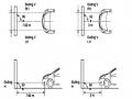
The installation location of the turn signal is shown in Figure 3.1. The turn signal control switch is located in the combination switch under the steering wheel. Turning this switch to the right or left will make the turn signal turn right or left.
The hazard light switch is used when the vehicle has a problem while participating in traffic. When the hazard light switch is turned on, all the turn signals on the vehicle will light up at a certain frequency. The hazard light switch is usually placed separately from the turn signal switch (some old cars integrate the hazard and turn signal switches on the same combination switch cluster).
Figure 3.1 Turn signal switch Figure 3.2 Hazard switch
The part that generates the flashing frequency for the lights is called a turn signal relay. The turn signal relay usually has 3 terminals: B (positive power supply); E (negative power supply); L (providing the turn signal switch to distribute to the
lamp)
2.1.1. Circuit diagram
To generate the frequency for the turn signal, a turn signal relay is used in the turn signal circuit. The current from the turn signal relay will be sent to the turn signal switch assembly to distribute the current to the turn signal lights for the driver's purpose.
Figure 3.3. Schematic diagram of a turn signal circuit without a hazard switch
1. Battery; 2. Electric lock; 3. Turn signal relay; 4. Turn signal switch; 5. Turn signal lamp; 6. Turn signal lamp; 7. Hazard switch
Figure 3.4 Schematic diagram of turn signal circuit with hazard switch
1. Battery; 2. Combination switch cluster; 3. Turn signal;
4. Turn signal light; 5. Turn signal relay
Today's cars no longer use three-pin turn signal relays (B, L, E) but use eight-pin turn signal relays (figure 3.5) (pin number 8 is used for hazard lights).
For this type, the current supplying the turn signal lights is supplied directly from the turn signal relay to the lights.
div.maincontent .p { color: black; font-family:"Times New Roman", serif; font-style: normal; font-weight: normal; text-decoration: none; font-size: 14pt; margin:0pt; } div.maincontent p { color: black; font-family:"Times New Roman", serif; font-style: normal; font-weight: normal; text-decoration: none; font-size: 14pt; margin:0pt; } div.maincontent .s1 { color: black; font-family:"Times New Roman", serif; font-style: normal; font-weight: normal; text-decoration: none; font-size: 13pt; } div.maincontent .s2 { color: black; font-family:"Times New Roman", serif; font-style: italic; font-weight: normal; text-decoration: none; font-size: 14pt; } div.maincontent .s3 { color: black; font-family:"Times New Roman", serif; font-style: normal; font-weight: normal; text-decoration: none; font-size: 14pt; } div.maincontent .s4 { color: black; font-family:"Times New Roman", serif; font-style: normal; font-weight: normal; text-decoration: none; font-size: 13pt; } div.maincontent .s5 { color: black; font-family:"Times New Roman", serif; font-style: normal; font-weight: normal; text-decoration: none; font-size: 13pt; vertical-align: 1pt; } div.maincontent .s6 { color: black; font-family:"Times New Roman", serif; font-style: normal; font-weight: normal; text-decoration: none; font-size: 11pt; } div.maincontent .s7 { color: black; font-family:"Times New Roman", serif; font-style: normal; font-weight: normal; text-decoration: none; font-size: 14pt; vertical-align: -9pt; } div.maincontent .s8 { color: black; font-family:"Times New Roman", serif; font-style: normal; font-weight: normal; text-decoration: none; font-size: 11pt; } div.maincontent .s9 { color: #008000; font-family:"Times New Roman", serif; font-style: normal; font-weight: normal; text-decoration: none; font-size: 14pt; } div.maincontent .s10 { color: black; font-family:"Times New Roman", serif; font-style: italic; font-weight: normal; te
Car body electrical practice - 8
zt2i3t4l5ee
zt2a3gs
zt2a3ge
zc2o3n4t5e6n7ts
If the voltage is out of specification, replace the wire or connector.
If the voltage is within specification, install the front fog light relay and follow step 5.
Step 5 Check the front fog light switch
- Remove the D4 connector of the fog light switch
- Use a multimeter to measure the resistance of the front fog light switch.
Measurement location
Condition
Standard
D4-3 (BFG) -D4-4 (LFG)
Light switchFront Fog OFF
>10kΩ
D4-3 (BFG) -D4-4 (LFG)
Front fog light switchON
<1 Ω
- Standard resistor
D4 connector is located on the combination switch assembly.
If the resistance is out of specification, replace the combination switch (the fog light switch is located in the combination switch).
If the resistance is within specification, follow step 6.
Step 6 Check wiring and connectors (front fog light relay-light selector switch)
- Disconnect connector D4 of the combination switch assembly
- Use a voltmeter to measure the voltage value of jack D4 on the wire side.
Measurement location
Control modecontrol
Standard
D4-3 (BFG) - (-) AQ
TAIL
11 to 14 V
D4 connector for the wiring of the combination switch assembly
If the voltage does not meet the standard, replace the wire or connector.
If the voltage is within standard, there may have been an error in the previous measurements.
Step 7 Check the front fog lights
- Remove the front fog light electrical connector.
- Supply battery voltage to the fog lamp terminals
Jack 8, B9 of front fog lamp on the electrical side
blind first.
Power supply location
Terms and Conditions
Battery positive terminal - Terminal 2Battery negative terminal - Terminal 1
Fog lightsbefore morning
- If the light does not come on, replace the bulb.
If the light is on, re-plug the jack and continue to step 8.
Step 8 Check wiring and connectors (relay and front fog lights)
- Disconnect the B8 and B9 connectors of the front fog lights.
- Use a voltmeter to measure voltage at the following locations:
Measurement location
Switch location
Terms and Conditions
B8-2 - (-) AQ
Electric lock ON TAIL size switchFog switch ON
11 to 14 V
B9-2 - (-) AQ
Electric lock ONTAIL size switch Fog switch ON
11 to 14 V
B8 and B9 connectors on the front fog lamp wiring side
Voltage is not up to standard, repair or replace the jack. If up to standard, there may have been an error in the measurement process.
2.2.4. Procedure for removing, installing and adjusting fog lights 1. Procedure for removing
- Remove the front inner ear pads
Use a screwdriver to remove the 3 screws and remove the front part of the front inner ear liner
-Remove the fog light assembly
+ Disconnect the connector.
+ Use a screwdriver to remove 3 screws to remove the fog light cover
2. Installation sequence
-Rotate the fog lamp bulb in the direction indicated by the arrow as shown in the figure and remove the fog lamp from the fog lamp assembly.
-Rotate the fog light bulb in the direction indicated by the arrow as shown in the figure and install the light into the fog light assembly.
- Use a screwdriver to install the fog light cover
-Install the electrical connector
Attention: Be careful not to damage the plastic thread on the lamp assembly.
- Install the front inner ear pads
Use a screwdriver to install the front inner bumper with 3 screws.
3. Prepare the vehicle to adjust the fog light convergence. Prepare the vehicle:
- Make sure there is no damage or deformation to the vehicle body around the fog lights.
- Add fuel to the fuel tank
- Add oil to standard level.
- Add engine coolant to standard level.
- Inflate the tire to standard pressure.
- Place spare tire, tools and jack in original design position
- Do not leave any load in the luggage compartment.
- Let a person weighing about 75 kg sit in the driver's seat.
4. Prepare to check the fog light convergence
a/ Prepare the vehicle status as follows:
- Place the car in a dark enough place to see the lines. The lines are the dividing line, below which the light from the fog lights can be seen but above which it cannot.
- Place the car perpendicular to the wall.
- Keep a distance of 7.62 m between the center of the fog lamp and the wall.
- Park the car on level ground.
- Press the car down a few times to stabilize the suspension.
Note: A distance of approximately 7.62 m is required between the vehicle (fog lamp center) and the wall to adjust the convergence correctly. If the distance of 7.62 m cannot be achieved, set the correct distance of 3 m to check and adjust the fog lamp convergence. (Since the target area varies with the distance, please follow the instructions as shown in the figure.)
b/ Prepare a piece of thick white paper about 2 m high and 4 m wide to use as a screen.
c/ Draw a vertical line through the center of the screen (line V).
d/ Set the screen as shown in the picture. Note:
- Keep the screen perpendicular to the ground.
- Align the V line on the screen with the center of the vehicle.
e/Draw the reference lines (H, V LH and V RH lines) on the screen as shown in the figure.HINT:
Mark the center of the fog lamp on the screen. If the center mark cannot be seen on the fog lamp, use the center of the fog lamp or the manufacturer's name mark on the fog lamp as the center mark.
H line (fog light height):
Draw a line across the screen so that it passes through the center mark. Line H should be at the same height as the center mark of the fog light bulb.
Line V LH, V RH (center mark position of left fog lamp LH and right fog lamp RH):
Draw two lines so that they intersect line H at the center marks.
5. Check the fog light convergence
a/ Cover the fog lamp or remove the connector of the other side fog lamp to prevent light from the unchecked fog lamp from affecting the fog lamp convergence test.
b/ Start the engine.
c/ Turn on the fog lights and make sure that the dividing line is outside the standard area as shown in the drawing.
6. Adjust the fog light convergence
Use a screwdriver to adjust the fog light to the standard area by turning the toe adjustment screw.
Note: If the screw is adjusted too far, loosen it and then tighten it again, so that the last rotation of the light adjustment screw is clockwise.
3. Self-study questions
1. Describe the operating principle of the lighting system with automatic headlight function
2. Describe the operating principle of the lighting system with the function of rotating headlights when turning
3. Draw diagram and connect lighting system on Hyundai Porter car
4. Draw diagram and connect lighting system on Honda Accord 1992
5. Draw the lighting circuit on a 1993 Toyota Lexus
LESSON 3 MAINTENANCE AND REPAIR OF SIGNAL SYSTEM
I. IMPLEMENTATION GOAL
After completing this lesson, students will be able to:
- Distinguish between types of signals on cars
- Correctly describe common symptoms and suspected areas causing damage.
- Connecting signal circuits ensures technical requirements
- Disassemble, install, check, maintain and repair the signal system to ensure technical requirements.
- Ensure safety in work and industrial hygiene
II. LESSON CONTENT
1. General description
The signal system equipped on cars aims to create signals to notify other vehicles participating in traffic about the vehicle's operating status such as: stopping, parking, braking, reversing, turning...
Signals are used either by light such as headlamps, brake lights, turn signals….. or by sound such as horns, reverse music….
Just like the lighting system. A signal system circuit usually consists of: battery, fuse, wire, relay, electrical load and control switch. Only some switches of the signal system are on the combination switch. The switches of other signals are usually located in different locations such as in the gearbox or brake pedal……
2. Maintenance and repair
2.1. Turn signals and hazard lights
The installation location of the turn signal is shown in Figure 3.1. The turn signal control switch is located in the combination switch under the steering wheel. Turning this switch to the right or left will make the turn signal turn right or left.
The hazard light switch is used when the vehicle has a problem while participating in traffic. When the hazard light switch is turned on, all the turn signals on the vehicle will light up at a certain frequency. The hazard light switch is usually placed separately from the turn signal switch (some old cars integrate the hazard and turn signal switches on the same combination switch cluster).
Figure 3.1 Turn signal switch Figure 3.2 Hazard switch
The part that generates the flashing frequency for the lights is called a turn signal relay. The turn signal relay usually has 3 terminals: B (positive power supply); E (negative power supply); L (providing the turn signal switch to distribute to the
lamp)
2.1.1. Circuit diagram
To generate the frequency for the turn signal, a turn signal relay is used in the turn signal circuit. The current from the turn signal relay will be sent to the turn signal switch assembly to distribute the current to the turn signal lights for the driver's purpose.
Figure 3.3. Schematic diagram of a turn signal circuit without a hazard switch
1. Battery; 2. Electric lock; 3. Turn signal relay; 4. Turn signal switch; 5. Turn signal lamp; 6. Turn signal lamp; 7. Hazard switch
Figure 3.4 Schematic diagram of turn signal circuit with hazard switch
1. Battery; 2. Combination switch cluster; 3. Turn signal;
4. Turn signal light; 5. Turn signal relay
Today's cars no longer use three-pin turn signal relays (B, L, E) but use eight-pin turn signal relays (figure 3.5) (pin number 8 is used for hazard lights).
For this type, the current supplying the turn signal lights is supplied directly from the turn signal relay to the lights.
div.maincontent .p { color: black; font-family:"Times New Roman", serif; font-style: normal; font-weight: normal; text-decoration: none; font-size: 14pt; margin:0pt; } div.maincontent p { color: black; font-family:"Times New Roman", serif; font-style: normal; font-weight: normal; text-decoration: none; font-size: 14pt; margin:0pt; } div.maincontent .s1 { color: black; font-family:"Times New Roman", serif; font-style: normal; font-weight: normal; text-decoration: none; font-size: 13pt; } div.maincontent .s2 { color: black; font-family:"Times New Roman", serif; font-style: italic; font-weight: normal; text-decoration: none; font-size: 14pt; } div.maincontent .s3 { color: black; font-family:"Times New Roman", serif; font-style: normal; font-weight: normal; text-decoration: none; font-size: 14pt; } div.maincontent .s4 { color: black; font-family:"Times New Roman", serif; font-style: normal; font-weight: normal; text-decoration: none; font-size: 13pt; } div.maincontent .s5 { color: black; font-family:"Times New Roman", serif; font-style: normal; font-weight: normal; text-decoration: none; font-size: 13pt; vertical-align: 1pt; } div.maincontent .s6 { color: black; font-family:"Times New Roman", serif; font-style: normal; font-weight: normal; text-decoration: none; font-size: 11pt; } div.maincontent .s7 { color: black; font-family:"Times New Roman", serif; font-style: normal; font-weight: normal; text-decoration: none; font-size: 14pt; vertical-align: -9pt; } div.maincontent .s8 { color: black; font-family:"Times New Roman", serif; font-style: normal; font-weight: normal; text-decoration: none; font-size: 11pt; } div.maincontent .s9 { color: #008000; font-family:"Times New Roman", serif; font-style: normal; font-weight: normal; text-decoration: none; font-size: 14pt; } div.maincontent .s10 { color: black; font-family:"Times New Roman", serif; font-style: italic; font-weight: normal; te -
 Managing teaching capacity building activities for teachers of high schools in Binh Giang district, Hai Duong province to meet the requirements of educational innovation - 16
 -
 Natural Features, Flood Control and Drainage Dyke System of the Study Area
 -
 The Training and Development Program for Leadership Staff Has Not Really Contributed to Improving the Effectiveness of Strategic Thinking to Meet Requirements
 -
 Innovation in the Content and Leadership Methods of Provincial Party Committees in the Red River Delta to Meet the Requirements of Building Defense Areas in the Current Stage

Table 2.12 Extracted results of flood location in 2006
TT
Name | Location | Element | Time of occurrence of water | |||
H (m) | Q (m3 / s) | V (m/s) | ||||
1 | Luong Phuc | Viet Long Commune - Soc Son District | 6.77 | -28.4 | -0.045 | 19-7-2006 9:30:00 |
2 | Manh Tan | Thuy Lam Commune - Soc Son District | 6.73 | 0 | 0.031 | 19-7-2006 9:30:00 |
3 | Phu Cuong | Phu Cuong Commune - Soc Son District | 6.77 | 54 | 0.167 | 19-7-2006 9:30:00 |
4 | Xuan Phuong | Tan Dan Commune - Soc Son District | 6.79 | 58 | 0.196 | 19- VII - 2006 9:30:00 |
Table 2.13 Extracted results of flood occurrence locations in 2008
TT
Name | Location | Element | Time of occurrence of water | |||
H (m) | Q (m3 / s) | V (m/s) | ||||
1 | Luong Phuc | Viet Long Commune - Soc Son District | 7.05 | -239 | -0.174 | 1-11-2010 6:00:00 |
2 | Manh Tan | Thuy Lam Commune - Soc Son District | 7.02 | -93.9 | -0.128 | 1- XI -2010 6:00:00 |
3 | Phu Cuong | Phu Cuong Commune - Soc Son District | 6.99 | -48.5 | -0.05 | 1- XI -2010 6:00:00 |
4 | Xuan Phuong | Tan Dan Commune - Soc Son District | 6.97 | -38.8 | -0.135 | 1- XI -2010 6:00:00 |
Comparing the highest flood levels at stations on the Ca Lo River with Phuc Loc Phuong station on the Cau River in the years 1965-1975 and 2006-2011 shows that it is completely consistent with previous studies and the actual situation in the basin.
The appearance of heavy rain in the fields and high water levels outside the Cau River caused congestion and backwater phenomena, hindering the drainage of water from the Ca Lo River to the Cau River.
Water from Cau River is an important cause of flooding in the downstream of Ca Lo River, especially in low-lying basins. Currently, flood drainage only uses the self-flowing drainage solution to Cau River.
2.3.5. The drainage system does not meet the requirements.
From the flood prevention planning report of Vinh Phuc province and the irrigation development planning of Hanoi city, and based on the current status of drainage works in Vinh Phuc province and Hanoi city (section 2.2.2), it can be seen that the irrigation planning of the province (period 2005-2010) is no longer suitable in the actual situation, specifically:
1) Some works were built a long time ago and are now degraded and damaged, while the water-blocking works are not yet complete. Current drainage works in the basin are still lacking, including headworks and drainage canal systems;
2) The design drainage coefficient is no longer suitable: The works were built a long time ago, are not synchronous, and the drainage level is low (in the 1960s and 1970s, the drainage coefficient was usually 1.8-4.6 l/s.ha, after 1970 until now it has increased to 6-7 l/s.ha to meet the drainage requirements for agriculture).
3) Most of the current pumping station capacity from irrigation works cannot meet the requirements for pumping and drainage and are often passive, while the drainage capacity on the Phan - Ca Lo riverbed is poor, below 200 m3 / s.
The current status of drainage works in the Phan - Ca Lo river basin in Vinh Phuc province is not built synchronously, only serving local drainage in the system with self-flowing drainage to Cau river; there is no overall drainage solution for the entire Phan - Ca Lo river system. Areas that are regularly flooded and can only grow one crop per year such as Vinh Tuong and Yen Lac (in the Phan - Ca Lo river area) have not invested in building pumping stations to thoroughly drain water.
2.3.6. General comments and assessments
Based on the above analysis, we can draw out 5 main causes of flooding in the Phan - Ca Lo river basin: Topography, characteristics of rain and flood, distribution and meandering of the river network, influence of water on the Cau river, current capacity of drainage and flood discharge. Based on the analysis of the causes of flooding, the thesis proposes solutions to the problem of drainage and flood discharge in the entire basin, specifically:
1) Existing studies have only stopped at solving each region. When there is a flood in the basin, local drainage is implemented, leading to drainage in one region but causing flooding in another. Therefore, there needs to be a comprehensive drainage solution for the entire Phan - Ca Lo river system to be able to drain synchronously and thoroughly.
2) Floods are the main cause of inundation in the Phan-Ca Lo river basin with total rainfall during flood season accounting for 85% of the year. Therefore, it is necessary to use non-structural measures such as afforestation at the source, flood forecasting and warning; building a system of control points and monitoring water levels and flows when there are prolonged floods.
3) The basin terrain is a mixture of mountains, midlands, and plains in the form of depressions and basins. Surrounding the basin are large rivers: Red River, Pho Day River, and Cau River. When floods from upstream combine with water from Cau River, it contributes to making the flooding situation in the river basin increasingly serious. The natural drainage method cannot drain the flood water in time, it is necessary to supplement forced drainage by arranging pumping stations to drain into the rivers around the basin .
4) The upstream part has many tributaries. When it rains heavily, the flow from short and steep tributaries flows downstream at the entry points (the distance between entry points is less than 10 km) in large quantities, leading to local flooding in the entry area. Therefore, the problem of placing flow control sluices downstream of tributaries to control the flow to the entry points needs to be considered in the overall problem.
5) Phan - Ca Lo River is a relatively curved river with a sinuosity coefficient of 2.7, leading to complex riverbed developments, and the process of riverbed erosion rapidly changes the shape of the river. Therefore, measures to cut off and clear the flow also need to be put forward. This is a measure to help circulate the flow, increase land fund, and is very suitable for the ecological development orientation in Dong Anh and Soc Son districts. However, the impact of water also needs to be analyzed and evaluated when using this measure.
6) The drainage system in the basin was designed in the 60s at 1.8-4.6 l/s.ha, and increased in the following years; however, the drainage of flooding has not met the changes in crop structure and land use. The flood drainage system is degraded, some areas have been upgraded but not synchronously, leading to drainage in one place but flooding in another. Thus, to solve the problem of drainage, it is necessary to set up a systematic problem .
Operation and management work to prevent and overcome flood damage is still lacking.
Information and equipment do not ensure operational operations. In addition, the development of floods in the basin is increasingly complex, with increasing intensity, especially in the context of climate change, making the complexity more and more unpredictable.
The objective of the study to solve the problem of flood drainage and drainage of Phan - Ca Lo river is to ensure stable flow, minimize and overcome the harmful effects of floods to ensure people's safety and socio-economic development. Phan - Ca Lo river basin has many different causes of flooding. The causes have mutual impacts. The level of flooding in the basin for each area has a different level of influence, depending on the development orientation of each area, there are different drainage requirements. To solve the problem of flooding in the basin, it is necessary to set up a comprehensive problem including the coordination of drainage measures, different levels of drainage required for each area.
2.4. Methods to solve flooding problems
2.4.1. General principles
The Phan - Ca Lo river basin system is a unified hydrological and hydraulic system, simultaneously affected by two natural factors: Rainfall regime in the basin - acting as an input source and boundary water level regime at the outlet that influences the flow regime over time . The chosen calculation method must simulate the rain-flow relationship in the basin from the formation of rain to the end of flow at the system's outlet boundaries. Therefore, to suit the conditions of the system and meet the assigned tasks, it is necessary to apply a comprehensive hydrological and hydraulic simulation model or a basin model .
However, as analyzed in the first part, the Phan - Ca Lo river basin is considered a closed basin, in which the flood-generating basin is mainly located in the upper Phan river and its tributaries. Therefore, depending on each component basin, the basin model can be applied if its morphological characteristics and hydrometeorological documents are determined, or the results of flow measurements from control cross-sections can be used as boundary conditions for hydraulic calculations in the river system.
Based on the investigation, survey and assessment of the flooding situation in the basin during the flood of XI/2008, the thesis used a simulation model tool to analyze the flooding situation in the basin more clearly, and at the same time evaluate the effectiveness of the parameter set in the model for calculation.
2.4.2. Selection and brief introduction of calculation model
a) General principles
The flow within the calculated river network has complex confluences and dispersions due to the simultaneous influence of flood flows at the upper boundaries and water levels at the lower boundaries. The most suitable and popular simulation method is described by a system of partial differential equations, the Saint-Venant system of equations.
Currently, in the world as well as in our country, there are many models for solving Saint - Venant equations to serve many different exploitation purposes. The models are very diverse in terms of solving algorithms and input and output information processing methods based on the latest advances in information technology [70].
The above models are currently being applied by many domestic agencies for various purposes such as research, planning and design of water resources management and flood prevention systems. Over the years, many models have met urgent practical requirements such as planning the Red River flood prevention system.
- Thai Binh (VRSAP, MIKE), Red River Delta water use balance (WENDY), Mekong Delta flood prevention planning (VRSAP, KOD1, MIKE, ISIS), Red River - Thai Binh flood forecast (HEC-RAS, MIKE)...[70]. However, up to now, there has been no assessment or comparison of the applicability of the above models.
Practical application also shows that a model may be suitable for a certain exploitation purpose but not necessarily suitable for another exploitation purpose, especially in areas with different hydrometeorological conditions.
b) Model selection
In the thesis, the MIKE model set of the Danish Hydraulic Institute (DHI) is selected to calculate floods and inundation in the Phan - Ca Lo river system. The MIKE model is a familiar model applied by many authors and agencies to calculate and forecast floods, especially in the Northern Delta river system. In theory, this model is capable of simulating flood flows from rain, simulating the inundation process, meeting the tasks set in the inundation and flood drainage problem of the research basin.
Below is a summary of the model's simulation methods as well as an analysis of their advantages and disadvantages as a basis for selecting results.
The MIKE model suite developed by the Danish Hydraulic Institute (DHI) is integrated
combines many powerful tools that can solve basic problems in the field of water resources [67], [77].
The MIKE 11 model is a one-dimensional model on open canals, riverbanks, floodplains, on rivers and canals combined with simulation of rice fields, in which the hydraulic results in the rice fields are "pseudo-2-dimensional" and have been widely applied in Vietnam and the world.
The MIKE model set is currently widely applied in the world and in Vietnam in recent years because it has the following outstanding advantages [70]:
- As commercial software, the interface is very powerful, convenient to use, suitable for small and medium problems;
- Is a multi-functional integrated software suite that has been tested in practice;
- Linking with GIS (The connection with GIS tools is very strong, including creating Database, although additional GIS software such as ArcVieW or ArcGIS is required...);
- The model set includes many modules: MIKE BASIN, MIKE 11, MIKE 21, MIKE GIS, MIKE FLOOD, easily connected to modules of the MIKE family such as the MIKE-NAM rainfall - flow model, the MIKE 21 2D hydrodynamic model, reservoir operation... In addition, DHI has launched a tool to integrate both models on MIKE11 and MIKE21 to produce MIKE FLOOD,... helping users simulate flood spills and build flood maps.
Theoretical basis and details of MIKE software suite[93] refer to the documents that come with the software suite or access from DHI website such as User Guide, Technical Reference Guide...
The research area in the thesis is the Phan - Ca Lo river basin with a small area (1229 km 2 ), including 4 tributaries with complex terrain, including mountainous, midland and plain terrain, in which the mountainous part of the river is short and has a large slope, the low plain part is subject to frequent flooding. To solve the problem of flood drainage, it is necessary to combine 1-way and 2-way hydrological and hydraulic models. Therefore, applying single models to the entire Phan - Ca Lo river basin will not be as effective as applying the MIKE model set including many modules MIKE NAM, MIKE 11, MIKE 21, MIKE FLOOD... Specifically, the main objective of applying mathematical models for flood drainage in the Phan - Ca Lo river basin includes:
- Assess the flood drainage capacity of the river basin;
- Flood zoning in the basin with different levels;
- Evaluate the drainage efficiency of flood simulation calculation methods and build inundation maps and flood duration.
c) Use modules of the MIKE model suite for calculations
From the objectives set out in the research basin, the thesis selected the MIKE software package, in which MIKE- NAM is used as a rainfall-flow model to calculate flood flows for sub-basins in the Phan-Ca Lo river system, the inflow volume in the middle area is used as an input boundary for the MIKE 11 hydraulic model; the MIKE 11 model - a one-way hydraulic model is used to route flood flows on main rivers and tributaries from upstream to downstream, and is also an input boundary for the MIKE 21 model - a two-way hydraulic model and a combined model of the two one-way and two-way hydraulic models above - MIKE FLOOD is used to simulate flood overflows and build inundation and flood maps in the basin.
2.4.3. Selecting a hydrological and hydraulic calculation diagram for the Phan - Ca Lo river basin
a) Principle:
As described above, the Phan - Ca Lo river basin is considered a closed basin but the outlet (border) is directly affected by the hydrological and hydraulic regime of the Cau river basin. The Cau river flow at the outlet of the Phan - Ca Lo river acts as an "invisible spillway" that governs the spatial and temporal flow regime of the Phan - Ca Lo river.
According to the system approach and on the basis of the binding relationship of hydrological and hydraulic regime, when using the hydrological and hydraulic calculation model, Phan - Ca Lo River must be placed in the Cau River system, so the calculation boundary of Cau River is also chosen as the calculation boundary of Phan - Ca Lo River. Cau River basin is the basin that forms Thai Binh River and ends at the confluence of Duong, Thuong, Luc Nam Rivers at Pha Lai, where the tidal influence of the Gulf of Tonkin begins. Therefore, in hydraulic calculations for Cau River basin, hydraulic experts often take the calculation boundary for this river at Pha Lai station.
b) Prepare hydrological and hydraulic calculation diagrams
From the above principles, the hydrological and hydraulic calculation diagram of the Phan-Ca Lo river basin is designed as follows:
- On Cau River:
+ Upper boundary: River flow process at Gia Bay station;
+ Bottom boundary: Water level process at Pha Lai station.
- On Phan - Ca Lo River:
+ Upper boundary: The flow process of component basins is calculated from the rain-flow relationship;
+ Middle zone joining boundary: The inflow process at the nodes is calculated from the rain - flow relationship.
2.4.4. Hydrological calculation for the 2008 flood problem
1. Hydrological calculation
Figure 2.6 is a block diagram for performing the simulation problem sequence established on the model.
Elevation
Information
ground
Economic - social - environmental Flood impacts
Need for management and administration work
Population Stabilization Poverty Improvement Sustainable Development
SL Meteorology, Hydrology
SL cross section
DEM
MALE
MIKE FLOOD
XD SCRIPT
Flooded time
Flooded
Flooded area
SOLUTIONS FOR MANAGING AND DRAINAGE FLOODS IN PHAN-CA LO RIVER
MIKE 21
MIKE 11
Figure 2.6 Block diagram of flood problem implementation steps for Phan - Ca Lo river basin
The data used for calibration, verification and simulation calculation of the Mike NAM model flow are summarized in Table 2.14.