(Photo: Duong Thanh Xuan)
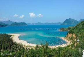
Figure 2.5: Xuan Dai BayFigure 2.6: O Loan Lagoon (Photo: Nguyen Thi Ngan) |
Maybe you are interested!
-

 Identify Rating Levels and Rating Scales
zt2i3t4l5ee
zt2a3gstourism,quan lan,quang ninh,ecology,ecotourism,minh chau,van don,geography,geographical basis,tourism development,science
zt2a3ge
zc2o3n4t5e6n7ts
of the islanders. Therefore, this indicator will be divided into two sub-indicators:
a1. Natural tourism attractiveness a2. Cultural tourism attractiveness
b. Tourist capacity
The two island communes in Quan Lan have different capacities to receive tourists. Minh Chau Commune is home to many standard hotels and resorts, attracting high-income domestic and international tourists. Meanwhile, Quan Lan Commune has many motels mainly built and operated by local people, so the scale and quality are not high, and will be suitable for ordinary tourists such as students.
c. Time of exploitation of Quan Lan Island Commune:
Quan Lan tourism is seasonal due to weather and climate conditions and festivals only take place on certain days of the year, specifically in spring. In Quan Lan commune, the period from April to June and from September to November is considered the best time to visit Quan Lan because the cultural tourism activities are mainly associated with festivals taking place during this time.
Minh Chau island commune:
Tourism exploitation time is all year round, because this is a place with a number of tourist attractions with diverse ecosystems such as Bai Tu Long National Park Research Center, Tram forest, Turtle Laying Beach, so besides coming to the beach for tourism and vacation in the summer, Minh Chau will attract research groups to come for tourism combined with research at other times of the year.
d. Sustainability
The sustainability of ecotourism sites in Quan Lan and Minh Chau communes depends on the sensitivity of the ecosystems to climate changes.
landscape. In general, these tourist destinations have a fairly high level of sustainability, because they are natural ecosystems, planned and protected. However, if a large number of tourists gather at certain times, it can exceed the carrying capacity and affect the sustainability of the environment (polluted beaches, damaged trees, animals moving away from their habitats, etc.), then the sustainability of the above ecosystems (natural ecosystems, human ecosystems) will also be affected and become less sustainable.
e. Location and accessibility
Both island communes have ports to take tourists to visit from Van Don wharf:
- Quan Lan – Van Don traffic route:
Phuc Thinh – Viet Anh high-speed boat and Quang Minh high-speed boat, depart at 8am and 2pm from Van Don to Quan Lan, and at 7am and 1pm from Quan Lan to Van Don. There are also wooden boats departing at 7am and 1pm.
- Van Don - Minh Chau traffic route:
Chung Huong high-speed train, Minh Chau train, morning 7:30 and afternoon 13:30 from Van Don to Minh Chau, morning 6:30 and afternoon 13:00 from Minh Chau to Van Don.
f. Infrastructure
Despite receiving investment attention, the issue of infrastructure and technical facilities for tourism on Quan Lan Island is still an issue that needs to be resolved because it has a direct impact on the implementation of ecotourism activities. The minimum conditions for serving tourists such as accommodation, electricity, water, communication, especially medical services, and security work need to be given top priority. Ecotourism spots in Minh Chau commune are assessed to have better infrastructure and technical facilities for tourism because there are quite complete and synchronous conditions for serving tourists, meeting many needs of domestic and foreign tourists.
3.2.1.4. Determine assessment levels and assessment scales
Corresponding to the levels of each criterion, the index is the score of those levels in the order of 4, 3, 2, 1 decreasing according to the standard of each level: very attractive (4), attractive (3), average (2), less attractive (1).
3.2.1.5. Determining the coefficients of the criteria
For the assessment of DLST in the two communes of Quan Lan and Minh Chau islands, the students added evaluation coefficients to show the importance of the criteria and indicators as follows:
Coefficient 3 with criteria: Attractiveness, Exploitation time. These are the 2 most important criteria for attracting tourists to tourism in general and eco-tourism in particular, so they have the highest coefficient.
Coefficient 2 with criteria: Capacity, Infrastructure, Location and accessibility . Because the assessment area is an island commune of Van Don district, the above criteria are selected by the author with appropriate coefficients at the average level.
Coefficient 1 with criteria: Sustainability. Quan Lan has natural and human-made ecotourism sites, with high biodiversity and little impact from local human factors. Most of the ecotourism sites are still wild, so they are highly sustainable.
3.2.1.6. Results of DLST assessment on Quan Lan island
a. Assessment of the potential for natural tourism development
For Minh Chau commune:
+ Natural tourism attractiveness is determined to be very attractive (4 points) and the most important coefficient (coefficient 3), so the score of the Attractiveness criterion is 4 x 3 = 12.
+ Capacity is determined as average (2 points) and the coefficient is quite important (coefficient 2), then the score of Capacity criterion is 2 x 2 = 4.
+ Exploitation time is long (4 points), the most important coefficient (coefficient 3) so the score of the Exploitation time criterion is 4 x 3 = 12.
+ Sustainability is determined as sustainable (4 points), the important coefficient is the average coefficient (coefficient 1), so the score of the Sustainability criterion is 4 x 1 = 4 points
+ Location and accessibility are determined to be quite favorable (2 points), the coefficient is quite important (coefficient 2), the criterion score is 2 x 2 = 4 points.
+ Infrastructure is assessed as good (3 points), the coefficient is quite important (coefficient 2), then the score of the Infrastructure criterion is 3 x 2 = 6 points.
The total score for evaluating DLST in Minh Chau commune according to 6 evaluation criteria is determined as: 12 + 4 + 12 + 4 + 4 + 6 = 42 points
Similar assessment for Quan Lan commune, we have the following table:
Table 3.3: Assessment of the potential for natural ecotourism development in Quan Lan and Minh Chau communes
Attractiveness of self-tourismof course
Capacity
Mining time
Sustainability
Location and accessibility
Infrastructure
Result
Point
DarkMulti
Point
DarkMulti
Point
DarkMulti
Point
DarkMulti
Point
DarkMulti
Point
DarkMulti
CommuneMinh Chau
12
12
4
8
12
12
4
4
4
8
6
8
42/52
Quan CommuneLan
6
12
6
8
9
12
4
4
4
8
4
8
33/52
b. Assessment of the potential for humanistic tourism development
For Quan Lan commune:
+ The attractiveness of human tourism is determined to be very attractive (4 points) and the most important coefficient (coefficient 3), so the score of the Attractiveness criterion is 4 x 3 = 12.
+ Capacity is determined to be large (3 points) and the coefficient is quite important (coefficient 2), then the score of the Capacity criterion is 3 x 2 = 6.
+ Mining time is average (3 points), the most important coefficient (coefficient 3) so the score of the Mining time criterion is 3 x 3 = 9.
+ Sustainability is determined as sustainable (4 points), the important coefficient is the average coefficient (coefficient 1), so the score of the Sustainability criterion is 4 x 1 = 4 points.
+ Location and accessibility are determined to be quite favorable (2 points), the coefficient is quite important (coefficient 2), the criterion score is 2 x 2 = 4 points.
+ Infrastructure is rated as average (2 points), the coefficient is quite important (coefficient 2), then the score of the Infrastructure criterion is 2 x 2 = 4 points.
The total score for evaluating DLST in Quan Lan commune according to 6 evaluation criteria is determined as: 12 + 6 + 6 + 4 + 4 + 4 = 36 points.
Similar assessment with Minh Chau commune we have the following table:
Table 3.4: Assessment of the potential for developing humanistic eco-tourism in Quan Lan and Minh Chau communes
Attractiveness of human tourismliterature
Capacity
Mining time
Sustainability
Location and accessibility
Infrastructure
Result
Point
DarkMulti
Point
DarkMulti
Point
DarkMulti
Point
DarkMulti
Point
DarkMulti
Point
DarkMulti
Quan CommuneLan
12
12
6
8
9
12
4
4
4
8
4
8
39/52
Minh CommuneChau
6
12
4
8
12
12
4
4
4
8
6
8
36/52
Basically, both Minh Chau and Quan Lan localities have quite favorable conditions for developing ecotourism. However, Quan Lan commune has more advantages to develop ecotourism in a humanistic direction, because this is an area with many famous historical relics such as Quan Lan Communal House, Quan Lan Pagoda, Temple worshiping the hero Tran Khanh Du, ... along with local festivals held annually such as the wind praying ceremony (March 15), Quan Lan festival (June 10-19); due to its location near the port and long exploitation time, the beaches in Quan Lan commune (especially Quan Lan beach) are no longer hygienic and clean to ensure the needs of tourists coming to relax and swim; this is also an area with many beautiful landscapes such as Got Beo wind pass, Ong Phong head, Voi Voi cave, but the ability to access these places is still very limited (dirt hill road, lots of gravel and rocks), especially during rainy and windy times; In addition, other natural resources such as mangrove forests and sea worms have not been really exploited for tourism purposes and ecotourism development. On the contrary, Minh Chau commune has more advantages in developing ecotourism in the direction of natural tourism, this is an area with diverse ecosystems such as at Rua De Beach, Bai Tu Long National Park Conservation Center...; Minh Chau beach is highly appreciated for its natural beauty and cleanliness, ranked in the top ten most beautiful beaches in Vietnam; Minh Chau commune is also home to Tram forest with a large area and a purity of up to 90%, suitable for building bridges through the forest (a very effective type of natural ecotourism currently applied by many countries) for tourists to sightsee, as well as for the purpose of studying and researching.
Figure 3.1: Thenmala Forest Bridge (India) Source: https://www.thenmalaecotourism.com/(August 21, 2019)
3.2.2. Using SWOT matrix to evaluate Quan Lan island tourism
General assessment of current tourism activities of Quan Lan island is shown through the following SWOT matrix:
Table 3.5: SWOT matrix evaluating tourism activities on Quan Lan island
Internal agent
Strengths- There is a lot of potential for tourism development, especially natural ecotourism and humanistic ecotourism.- The unskilled labor force is relatively abundant.- resource environmentunpolluted, still
Weaknesses- Poorly developed infrastructure, especially traffic routes to tourist destinations on the island.- The team of professional staff is still weak.- Tourism products in general
quite wild, originalintact
general and DLST in particularalone is monotonous.
External agents
Opportunity- Tourism is a key industry in the socio-economic development strategy of the province and Van Don economic zone.- Quan Lan was selected as a pilot area for eco-tourism development within the framework of the green growth project between Quang Ninh province and the Japanese organization JICA.- The flow of tourists and especially ecotourism in the world tends toincreasing
Challenge- Weather and climate change abnormally.- Competition in tourism products is increasingly fierce, especially with other localities in the province such as Ha Long, Mong Cai...- Awareness of tourists, especially domestic tourists, about ecotourism and nature conservation is not high.
Through summary analysis using SWOT matrix we see that:
To exploit strengths and take advantage of opportunities, it is necessary to:
- Diversify products and service types (build more tourism routes aimed at specific needs of tourists: experiential tourism immersed in nature, spiritual cultural tourism...)
- Effective exploitation of resources and differentiated products (natural resources and human resources)
div.maincontent .p { color: black; font-family:"Times New Roman", serif; font-style: normal; font-weight: normal; text-decoration: none; font-size: 14pt; margin:0pt; } div.maincontent p { color: black; font-family:"Times New Roman", serif; font-style: normal; font-weight: normal; text-decoration: none; font-size: 14pt; margin:0pt; } div.maincontent .s1 { color: black; font-family:"Times New Roman", serif; font-style: normal; font-weight: normal; text-decoration: none; font-size: 13pt; } div.maincontent .s2 { color: black; font-family:"Times New Roman", serif; font-style: normal; font-weight: normal; text-decoration: none; font-size: 13pt; } div.maincontent .s3 { color: #0D0D0D; font-family:"Times New Roman", serif; font-style: normal; font-weight: bold; text-decoration: none; font-size: 14pt; } div.maincontent .s4 { color: black; font-family:"Times New Roman", serif; font-style: italic; font-weight: normal; text-decoration: none; font-size: 14pt; } div.maincontent .s5 { color: black; font-family:"Times New Roman", serif; font-style: italic; font-weight: bold; text-decoration: none; font-size: 14pt; } div.maincontent .s6 { color: black; font-family:"Times New Roman", serif; font-style: italic; font-weight: normal; text-decoration: none; font-size: 14pt; vertical-align: -3pt; } div.maincontent .s7 { color: black; font-family:"Times New Roman", serif; font-style: italic; font-weight: normal; text-decoration: none; font-size: 14pt; vertical-align: -2pt; } div.maincontent .s8 { color: black; font-family:"Times New Roman", serif; font-style: italic; font-weight: normal; text-decoration: none; font-size: 14pt; vertical-align: -1pt; } div.maincontent .s9 { color: black; font-family:"Times New Roman", serif; font-style: normal; font-weight: normal; text-decoration: none; font-size: 14pt; } div.maincontent .s10 { color: black; font-family:"Times New Roman", serif; font-style: normal; font-weight: bold; text-decoration: none; font-size: 14pt; } div.maincontent .s11 { color: black; font-family:"Times New Roman", serif; font-style: normal; font-weight: normal; text-decoration: none; font-size: 14pt; } div.maincontent .s12 { color: black; font-family:Symbol, serif; font-style: normal; font-weight: normal; text-decoration: none; font-size: 14pt; } div.maincontent .s13 { color: black; font-family:Wingdings; font-style: normal; font-weight: normal; text-decoration: none; font-size: 14pt; } div.maincontent .s14 { color: black; font-family:"Times New Roman", serif; font-style: normal; font-weight: normal; text-decoration: none; font-size: 9pt; vertical-align: 5pt; } div.maincontent .s15 { color: black; font-family:"Times New Roman", serif; font-style: normal; font-weight: normal; text-decoration: none; font-size: 9pt; vertical-align: 5pt; } div.maincontent .s16 { color: black; font-family:Cambria, serif; font-style: italic; font-weight: normal; text-decoration: none; font-size: 14pt; } div.maincontent .s17 { color: #080808; font-family:"Times New Roman", serif; font-style: normal; font-weight: bold; text-decoration: none; font-size: 14pt; } div.maincontent .s18 { color: #080808; font-family:"Times New Roman", serif; font-style: normal; font-weight: normal; text-decoration: none; font-size: 14pt; } div.maincontent .s19 { color: black; font-family:"Times New Roman", serif; font-style: normal; font-weight: normal; text-decoration: none; font-size: 11pt; } div.maincontent .s20 { color: black; font-family:"Times New Roman", serif; font-style: normal; font-weight: normal; text-decoration: none; font-size: 10pt; } div.maincontent .s21 { color: black; font-family:"Times New Roman", serif; font-style: normal; font-weight: bold; text-decoration: none; font-size: 11pt; } div.maincontent .s22 { color: black; font-family:"Times New Roman", serif; font-style: normal; font-weight: normal; text-decoration: none; font-size: 11pt; } div.maincontent .s23 { color: black; font-family:"Times New Roman", serif; font-style: italic; font-weight: normal; text-decoration: none; font-size: 14pt; } div.maincontent .s24 { color: #212121; font-family:"Times New Roman", serif; font-style: normal; font-weight: normal; tex
Identify Rating Levels and Rating Scales
zt2i3t4l5ee
zt2a3gstourism,quan lan,quang ninh,ecology,ecotourism,minh chau,van don,geography,geographical basis,tourism development,science
zt2a3ge
zc2o3n4t5e6n7ts
of the islanders. Therefore, this indicator will be divided into two sub-indicators:
a1. Natural tourism attractiveness a2. Cultural tourism attractiveness
b. Tourist capacity
The two island communes in Quan Lan have different capacities to receive tourists. Minh Chau Commune is home to many standard hotels and resorts, attracting high-income domestic and international tourists. Meanwhile, Quan Lan Commune has many motels mainly built and operated by local people, so the scale and quality are not high, and will be suitable for ordinary tourists such as students.
c. Time of exploitation of Quan Lan Island Commune:
Quan Lan tourism is seasonal due to weather and climate conditions and festivals only take place on certain days of the year, specifically in spring. In Quan Lan commune, the period from April to June and from September to November is considered the best time to visit Quan Lan because the cultural tourism activities are mainly associated with festivals taking place during this time.
Minh Chau island commune:
Tourism exploitation time is all year round, because this is a place with a number of tourist attractions with diverse ecosystems such as Bai Tu Long National Park Research Center, Tram forest, Turtle Laying Beach, so besides coming to the beach for tourism and vacation in the summer, Minh Chau will attract research groups to come for tourism combined with research at other times of the year.
d. Sustainability
The sustainability of ecotourism sites in Quan Lan and Minh Chau communes depends on the sensitivity of the ecosystems to climate changes.
landscape. In general, these tourist destinations have a fairly high level of sustainability, because they are natural ecosystems, planned and protected. However, if a large number of tourists gather at certain times, it can exceed the carrying capacity and affect the sustainability of the environment (polluted beaches, damaged trees, animals moving away from their habitats, etc.), then the sustainability of the above ecosystems (natural ecosystems, human ecosystems) will also be affected and become less sustainable.
e. Location and accessibility
Both island communes have ports to take tourists to visit from Van Don wharf:
- Quan Lan – Van Don traffic route:
Phuc Thinh – Viet Anh high-speed boat and Quang Minh high-speed boat, depart at 8am and 2pm from Van Don to Quan Lan, and at 7am and 1pm from Quan Lan to Van Don. There are also wooden boats departing at 7am and 1pm.
- Van Don - Minh Chau traffic route:
Chung Huong high-speed train, Minh Chau train, morning 7:30 and afternoon 13:30 from Van Don to Minh Chau, morning 6:30 and afternoon 13:00 from Minh Chau to Van Don.
f. Infrastructure
Despite receiving investment attention, the issue of infrastructure and technical facilities for tourism on Quan Lan Island is still an issue that needs to be resolved because it has a direct impact on the implementation of ecotourism activities. The minimum conditions for serving tourists such as accommodation, electricity, water, communication, especially medical services, and security work need to be given top priority. Ecotourism spots in Minh Chau commune are assessed to have better infrastructure and technical facilities for tourism because there are quite complete and synchronous conditions for serving tourists, meeting many needs of domestic and foreign tourists.
3.2.1.4. Determine assessment levels and assessment scales
Corresponding to the levels of each criterion, the index is the score of those levels in the order of 4, 3, 2, 1 decreasing according to the standard of each level: very attractive (4), attractive (3), average (2), less attractive (1).
3.2.1.5. Determining the coefficients of the criteria
For the assessment of DLST in the two communes of Quan Lan and Minh Chau islands, the students added evaluation coefficients to show the importance of the criteria and indicators as follows:
Coefficient 3 with criteria: Attractiveness, Exploitation time. These are the 2 most important criteria for attracting tourists to tourism in general and eco-tourism in particular, so they have the highest coefficient.
Coefficient 2 with criteria: Capacity, Infrastructure, Location and accessibility . Because the assessment area is an island commune of Van Don district, the above criteria are selected by the author with appropriate coefficients at the average level.
Coefficient 1 with criteria: Sustainability. Quan Lan has natural and human-made ecotourism sites, with high biodiversity and little impact from local human factors. Most of the ecotourism sites are still wild, so they are highly sustainable.
3.2.1.6. Results of DLST assessment on Quan Lan island
a. Assessment of the potential for natural tourism development
For Minh Chau commune:
+ Natural tourism attractiveness is determined to be very attractive (4 points) and the most important coefficient (coefficient 3), so the score of the Attractiveness criterion is 4 x 3 = 12.
+ Capacity is determined as average (2 points) and the coefficient is quite important (coefficient 2), then the score of Capacity criterion is 2 x 2 = 4.
+ Exploitation time is long (4 points), the most important coefficient (coefficient 3) so the score of the Exploitation time criterion is 4 x 3 = 12.
+ Sustainability is determined as sustainable (4 points), the important coefficient is the average coefficient (coefficient 1), so the score of the Sustainability criterion is 4 x 1 = 4 points
+ Location and accessibility are determined to be quite favorable (2 points), the coefficient is quite important (coefficient 2), the criterion score is 2 x 2 = 4 points.
+ Infrastructure is assessed as good (3 points), the coefficient is quite important (coefficient 2), then the score of the Infrastructure criterion is 3 x 2 = 6 points.
The total score for evaluating DLST in Minh Chau commune according to 6 evaluation criteria is determined as: 12 + 4 + 12 + 4 + 4 + 6 = 42 points
Similar assessment for Quan Lan commune, we have the following table:
Table 3.3: Assessment of the potential for natural ecotourism development in Quan Lan and Minh Chau communes
Attractiveness of self-tourismof course
Capacity
Mining time
Sustainability
Location and accessibility
Infrastructure
Result
Point
DarkMulti
Point
DarkMulti
Point
DarkMulti
Point
DarkMulti
Point
DarkMulti
Point
DarkMulti
CommuneMinh Chau
12
12
4
8
12
12
4
4
4
8
6
8
42/52
Quan CommuneLan
6
12
6
8
9
12
4
4
4
8
4
8
33/52
b. Assessment of the potential for humanistic tourism development
For Quan Lan commune:
+ The attractiveness of human tourism is determined to be very attractive (4 points) and the most important coefficient (coefficient 3), so the score of the Attractiveness criterion is 4 x 3 = 12.
+ Capacity is determined to be large (3 points) and the coefficient is quite important (coefficient 2), then the score of the Capacity criterion is 3 x 2 = 6.
+ Mining time is average (3 points), the most important coefficient (coefficient 3) so the score of the Mining time criterion is 3 x 3 = 9.
+ Sustainability is determined as sustainable (4 points), the important coefficient is the average coefficient (coefficient 1), so the score of the Sustainability criterion is 4 x 1 = 4 points.
+ Location and accessibility are determined to be quite favorable (2 points), the coefficient is quite important (coefficient 2), the criterion score is 2 x 2 = 4 points.
+ Infrastructure is rated as average (2 points), the coefficient is quite important (coefficient 2), then the score of the Infrastructure criterion is 2 x 2 = 4 points.
The total score for evaluating DLST in Quan Lan commune according to 6 evaluation criteria is determined as: 12 + 6 + 6 + 4 + 4 + 4 = 36 points.
Similar assessment with Minh Chau commune we have the following table:
Table 3.4: Assessment of the potential for developing humanistic eco-tourism in Quan Lan and Minh Chau communes
Attractiveness of human tourismliterature
Capacity
Mining time
Sustainability
Location and accessibility
Infrastructure
Result
Point
DarkMulti
Point
DarkMulti
Point
DarkMulti
Point
DarkMulti
Point
DarkMulti
Point
DarkMulti
Quan CommuneLan
12
12
6
8
9
12
4
4
4
8
4
8
39/52
Minh CommuneChau
6
12
4
8
12
12
4
4
4
8
6
8
36/52
Basically, both Minh Chau and Quan Lan localities have quite favorable conditions for developing ecotourism. However, Quan Lan commune has more advantages to develop ecotourism in a humanistic direction, because this is an area with many famous historical relics such as Quan Lan Communal House, Quan Lan Pagoda, Temple worshiping the hero Tran Khanh Du, ... along with local festivals held annually such as the wind praying ceremony (March 15), Quan Lan festival (June 10-19); due to its location near the port and long exploitation time, the beaches in Quan Lan commune (especially Quan Lan beach) are no longer hygienic and clean to ensure the needs of tourists coming to relax and swim; this is also an area with many beautiful landscapes such as Got Beo wind pass, Ong Phong head, Voi Voi cave, but the ability to access these places is still very limited (dirt hill road, lots of gravel and rocks), especially during rainy and windy times; In addition, other natural resources such as mangrove forests and sea worms have not been really exploited for tourism purposes and ecotourism development. On the contrary, Minh Chau commune has more advantages in developing ecotourism in the direction of natural tourism, this is an area with diverse ecosystems such as at Rua De Beach, Bai Tu Long National Park Conservation Center...; Minh Chau beach is highly appreciated for its natural beauty and cleanliness, ranked in the top ten most beautiful beaches in Vietnam; Minh Chau commune is also home to Tram forest with a large area and a purity of up to 90%, suitable for building bridges through the forest (a very effective type of natural ecotourism currently applied by many countries) for tourists to sightsee, as well as for the purpose of studying and researching.
Figure 3.1: Thenmala Forest Bridge (India) Source: https://www.thenmalaecotourism.com/(August 21, 2019)
3.2.2. Using SWOT matrix to evaluate Quan Lan island tourism
General assessment of current tourism activities of Quan Lan island is shown through the following SWOT matrix:
Table 3.5: SWOT matrix evaluating tourism activities on Quan Lan island
Internal agent
Strengths- There is a lot of potential for tourism development, especially natural ecotourism and humanistic ecotourism.- The unskilled labor force is relatively abundant.- resource environmentunpolluted, still
Weaknesses- Poorly developed infrastructure, especially traffic routes to tourist destinations on the island.- The team of professional staff is still weak.- Tourism products in general
quite wild, originalintact
general and DLST in particularalone is monotonous.
External agents
Opportunity- Tourism is a key industry in the socio-economic development strategy of the province and Van Don economic zone.- Quan Lan was selected as a pilot area for eco-tourism development within the framework of the green growth project between Quang Ninh province and the Japanese organization JICA.- The flow of tourists and especially ecotourism in the world tends toincreasing
Challenge- Weather and climate change abnormally.- Competition in tourism products is increasingly fierce, especially with other localities in the province such as Ha Long, Mong Cai...- Awareness of tourists, especially domestic tourists, about ecotourism and nature conservation is not high.
Through summary analysis using SWOT matrix we see that:
To exploit strengths and take advantage of opportunities, it is necessary to:
- Diversify products and service types (build more tourism routes aimed at specific needs of tourists: experiential tourism immersed in nature, spiritual cultural tourism...)
- Effective exploitation of resources and differentiated products (natural resources and human resources)
div.maincontent .p { color: black; font-family:"Times New Roman", serif; font-style: normal; font-weight: normal; text-decoration: none; font-size: 14pt; margin:0pt; } div.maincontent p { color: black; font-family:"Times New Roman", serif; font-style: normal; font-weight: normal; text-decoration: none; font-size: 14pt; margin:0pt; } div.maincontent .s1 { color: black; font-family:"Times New Roman", serif; font-style: normal; font-weight: normal; text-decoration: none; font-size: 13pt; } div.maincontent .s2 { color: black; font-family:"Times New Roman", serif; font-style: normal; font-weight: normal; text-decoration: none; font-size: 13pt; } div.maincontent .s3 { color: #0D0D0D; font-family:"Times New Roman", serif; font-style: normal; font-weight: bold; text-decoration: none; font-size: 14pt; } div.maincontent .s4 { color: black; font-family:"Times New Roman", serif; font-style: italic; font-weight: normal; text-decoration: none; font-size: 14pt; } div.maincontent .s5 { color: black; font-family:"Times New Roman", serif; font-style: italic; font-weight: bold; text-decoration: none; font-size: 14pt; } div.maincontent .s6 { color: black; font-family:"Times New Roman", serif; font-style: italic; font-weight: normal; text-decoration: none; font-size: 14pt; vertical-align: -3pt; } div.maincontent .s7 { color: black; font-family:"Times New Roman", serif; font-style: italic; font-weight: normal; text-decoration: none; font-size: 14pt; vertical-align: -2pt; } div.maincontent .s8 { color: black; font-family:"Times New Roman", serif; font-style: italic; font-weight: normal; text-decoration: none; font-size: 14pt; vertical-align: -1pt; } div.maincontent .s9 { color: black; font-family:"Times New Roman", serif; font-style: normal; font-weight: normal; text-decoration: none; font-size: 14pt; } div.maincontent .s10 { color: black; font-family:"Times New Roman", serif; font-style: normal; font-weight: bold; text-decoration: none; font-size: 14pt; } div.maincontent .s11 { color: black; font-family:"Times New Roman", serif; font-style: normal; font-weight: normal; text-decoration: none; font-size: 14pt; } div.maincontent .s12 { color: black; font-family:Symbol, serif; font-style: normal; font-weight: normal; text-decoration: none; font-size: 14pt; } div.maincontent .s13 { color: black; font-family:Wingdings; font-style: normal; font-weight: normal; text-decoration: none; font-size: 14pt; } div.maincontent .s14 { color: black; font-family:"Times New Roman", serif; font-style: normal; font-weight: normal; text-decoration: none; font-size: 9pt; vertical-align: 5pt; } div.maincontent .s15 { color: black; font-family:"Times New Roman", serif; font-style: normal; font-weight: normal; text-decoration: none; font-size: 9pt; vertical-align: 5pt; } div.maincontent .s16 { color: black; font-family:Cambria, serif; font-style: italic; font-weight: normal; text-decoration: none; font-size: 14pt; } div.maincontent .s17 { color: #080808; font-family:"Times New Roman", serif; font-style: normal; font-weight: bold; text-decoration: none; font-size: 14pt; } div.maincontent .s18 { color: #080808; font-family:"Times New Roman", serif; font-style: normal; font-weight: normal; text-decoration: none; font-size: 14pt; } div.maincontent .s19 { color: black; font-family:"Times New Roman", serif; font-style: normal; font-weight: normal; text-decoration: none; font-size: 11pt; } div.maincontent .s20 { color: black; font-family:"Times New Roman", serif; font-style: normal; font-weight: normal; text-decoration: none; font-size: 10pt; } div.maincontent .s21 { color: black; font-family:"Times New Roman", serif; font-style: normal; font-weight: bold; text-decoration: none; font-size: 11pt; } div.maincontent .s22 { color: black; font-family:"Times New Roman", serif; font-style: normal; font-weight: normal; text-decoration: none; font-size: 11pt; } div.maincontent .s23 { color: black; font-family:"Times New Roman", serif; font-style: italic; font-weight: normal; text-decoration: none; font-size: 14pt; } div.maincontent .s24 { color: #212121; font-family:"Times New Roman", serif; font-style: normal; font-weight: normal; tex -
 The Nature and Role of the Internal Control System
 -
 Types of lonely characters in contemporary Vietnamese prose through some typical works of Nguyen Huy Thiep, Ta Duy Anh, Chu Lai and Nguyen Danh Lam - 14
 -
 For Exploiting Types of Tourism
 -
 Types of Literary Materials That Can Be Used in Teaching Vietnamese History Grade 10 in High Schools
2.2.3. Coastal islands and coastal cliffs
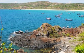
Along the coast of Phu Yen, there are many small islands: Cu Lao Mai Nha (1.5km 2 ), Hon Chua ( 0.22km 2 ), Hon Yen (0.0198km 2 ), Hon Dua (0.02km 2 ), Hon Than (0.01km 2 ), Hon Co (0.15km 2 ), Hon Nua (0.60km 2 )... Around the islands are beautiful coral reefs, where small fish and other seafood species grow and develop. The islands are all small in area, mainly granite islands, steep cliffs, interspersed with pebble beaches and narrow sand beaches. On some islands and rocky headlands, there are bird nest caves (Ganh Ba, Mui Ong Dien ...) [63]. In addition, along the coast there are many unique rocky capes such as Ganh Da Dia, Ganh Den (An Ninh Dong commune); Ganh Tuong, Ganh Do (Xuan Dai bay); Da Bia mountain ...
The value of the system of islands and coastal rocks in Phu Yen province for tourism is first of all the landscape value and the unique, special and majestic value for tourism activities such as sightseeing, relaxation and sea sports.
Table 2.4: Characteristics of islands and coastal rocks in Phu Yen
TT
Name of island, cliff. | Location | Geological and geomorphological features | General assessment | |||
Structure | Morphology | Ecosystem | ||||
1 | Hon Chua | An Phu Commune, Tuy Hoa City Peace | Island made of granite complex | Low, gentle, 800m long, widest: 400m, area: 22ha, has beach narrow southwest of the island. | Lots of coral, bottom animals and aquarium fish. | Wild, beautiful, clean, close to shore, easy to access |
2 | Hon Yen Complex | An Hoa Commune, Tuy An District | Rocky island, made of basalt, with coral reefs. | Low, 549m long, 370m wide, steep cliffs, many bird nest caves | There are many swiftlets, terns, seagulls, and coral reefs. | Pristine, beautiful, clean, close to shore, accessible (possible) wading at low tide |
3 | Mai Island Home | An Hai commune, district | Granite Island, many haunts | Low (highest 104m), 1.7km long, widest 1.3km, area | Lots of coral and algae sea, many | 4km from shore (O Loan lagoon), easy to reach approach. Island |
(Plunge Island) Roof) | Tuy An | coral pepper | 1.5km2 , with many walls rock, rock beach, sand beach near the island | ornamental fish, tuna... | pristine, clean | |
4 | Hon Nua | Hoa Xuan Commune, Dong Hoa District | Granite Island, many cracks | Low (highest 105m), 950m long, widest: 500m, area: 0.6km2 , has a narrow beach, fine white sand, arc-shaped, long about 500m from the island. | Many corals and seaweeds, many species of ornamental fish, | 4km from shore, easy to access. Pristine, clean island. |
5 | Nhat Tu Son | Xuan Tho 1 Commune, TX Song Cau | Granite Island, | Low (highest 40m), length > 800m, width 230m, area about 11ha, with steep cliffs, gravel beach | Dense scrub forest, acacia, coral reefs on the island | Very close to shore, can wade across at low tide, |
6 | Ganh Da Dia | Village 6, An Ninh Dong commune, Tuy An district | Columnar basalt rock formation | 50m wide; 2km long, 200m exposed; The rocks are black or brown-yellow, hexagonal and octagonal, stacked in columns, half submerged and half floating on the surface. water. | Bushes around the cliff, rocky beaches, beautiful beaches nearby. | Beautiful scenery, clear blue water. There are steps down to the cliff, you can climb on the rocks to visit. explore |
Source [1];[62]
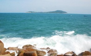
Figure 2.8: Mai Nha Islet (photo: Nguyen Huu Xuan) | |
Figure 2.9: Ganh Da Dia (photo: Nguyen Huu Xuan) | Figure 2.10: Da Bia Mountain (photo: Nguyen Huu Xuan) |
2.2.4. Terrain types: hills, mountains, plateaus
Phu Yen has many types of terrain such as mountains, low hills and mountains distributed in coastal and plain areas, creating beautiful landscapes, very valuable for tourism. In addition, there is also a plateau terrain distributed at an altitude of 400m above sea level, with a cool climate, rich vegetation, a place with potential for PTDL sightseeing and relaxation (Table 2.5).
Table 2.5: Types of hills, mountains, and plateaus valuable for tourism
TT
TNTN form | Distribution | Basic features | General assessment | |
1 | Fragrant Mountain (hill) | An Phu Commune, City Tuy Hoa | Area 45.15ha. It is a mountainous area located close to National Highway 1A, with many tourist services. | Has beautiful views and location favorable |
2 | Nhan Mountain (hill) | Ward 1, Tuy Hoa City | 60m high, the circumference around the mountain is over 1km. There is a special national cultural heritage (Nhan tower), there is a martyrs memorial. From the top of the mountain, you can see the whole Tuy Hoa city, Binh Ngoc vegetable and flower village, Da Bia mountain, the East sea, the railway bridge, the northern road. across the Da Rang River | Beautiful landscape, cultural and historical value, convenient location |
3 | Van Hoa Plateau | Belonging to Son Long, Son Dinh and Son Xuan communes - Son Hoa district | Altitude 400m. Average summer temperature 27.4 0 C; winter 24.7 0 C. This is a red basalt land area consisting of 3 very large mounds called big mounds: Phu Tan, Quan Le, Phuoc Hoa; surrounded by vast primeval forests. | Beautiful landscape, converging many scenic spots and historical relics, cool climate, TĐTL location |
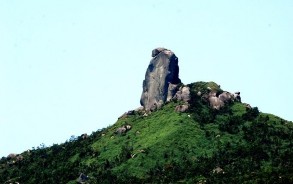
4 | Chop Chai Mountain (mountain) | Belonging to Hoa Kien and Binh Kien communes - Tuy Hoa city | Area 61ha, height 391m. It is a mountainous area located close to National Highway 1A, with beautiful scenery. From the top of the mountain, you can see a panoramic view of Phu Yen. On the mountainside, there are 4 temples. Pagodas: Hoa Son, Minh Son, Khanh Son, Bao Lam | Beautiful scenery and prime location |
5 | Stone Mountain (mountain) | Hoa Xuan Nam Commune, Dong Hoa District | Height: 706m. Area: 1000 ha. The mountain top has a rock mass about 76m high. | Rich and diverse broadleaf forest ecosystem; Beautiful landscape, rugged terrain |
Source: [1]
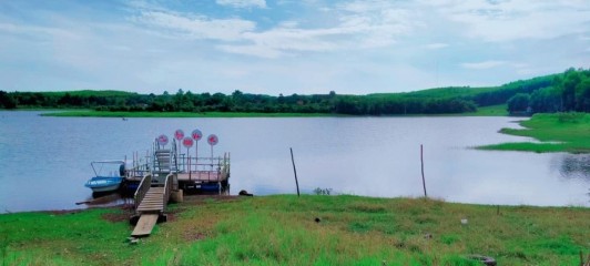
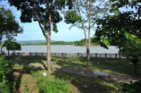
Figure 2.1: Long Van Lake on Van Hoa plateau (photo: Nguyen Thi Ngan)
2.2.5. Terrain types: lakes, dams, waterfalls, streams
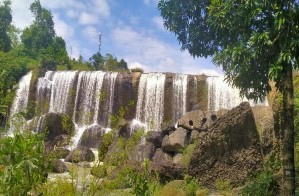
The terrain types of lakes, dams, streams, and waterfalls are distributed in the western region of Phu Yen province, many of which have become attractive tourist destinations. These types of resources will become valuable natural resources for local tourism development if properly invested and exploited, and will supplement the coastal tourism system in the East to create a balanced East-West development. The characteristics of these terrain types are as follows:
2.2.6.1. Lake
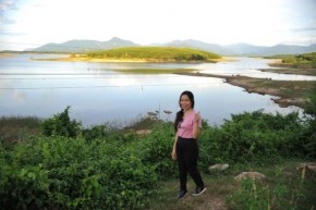
- Song Hinh Hydroelectric Lake: The lake is about 35 km southwest of Tuy Hoa City. The water surface area is 4,100 hectares. There are a few small islands on the lake, surrounded by natural vegetation. In the dry season, the lake water is clear, people and tourists often come here to fish. The climate is cool and fresh all year round, suitable for sightseeing, entertainment and ecological tourism.
- Xuan Huong Lake: The lake is located in the center of Hai Rieng town (Song Hinh district), with a water surface area of 17 hectares. The lake surface is clear blue, surrounded by many trees, especially pine forests near the lake, with a fresh, cool climate all year round. The lake has a concrete bridge across it connecting to the "tourist" village in Le Diem hamlet. The suitable tourist activity here is eco-tourism associated with learning about the unique culture of ethnic minorities.
- Ba Ha River Hydroelectric Lake: Belonging to Song Hinh and Son Hoa districts, with a water surface area of 3,134 hectares, surrounded by deep green mountains and forests, in the middle is a vast lake with a few small islands, cool and fresh climate. Near the lake are ethnic minority villages with unique cultural features. This place is suitable for sightseeing, admiring the majestic natural scenery and the "water-blocking electricity" architectural works of humans. This place is suitable for tourists who love to explore nature.
(Photo: Nguyen Huu Xuan)
Figure 2. 2: Song Hinh Hydroelectric ReservoirFigure 2.3: Xuan Huong Lake (Photo: Nguyen Thi Ngan) |
- Hao Son Lake (Sea Lake): Located in Hoa Xuan Nam commune, Dong Hoa district. The lake has a water surface area of 66 hectares. In the rainy season, the lake is deeply flooded, the lake bed widens, in the dry season the lake bed narrows, lotus grows densely, blooming from the end of March to August creating a very beautiful lotus lake.
- My Lam Reservoir: Located in Hoa Thinh and Hoa My Tay communes, Tay Hoa district. The lake has a water surface area of 10 hectares, surrounded by vegetation, with a fresh, cool climate all year round.
- Dong Tron Reservoir: Located in An Nghiep Commune, Tuy An District. The lake has a water surface area of 165 hectares, surrounded by rich vegetation, lakeside beaches, fresh and cool climate all year round.
2.2.6.2. Dams, streams, waterfalls
Phu Yen is a province with many streams and waterfalls that are valuable for sightseeing and picnicking. These types of terrain are distributed in mountainous districts (Table 2.6).
Table 2.6: Dams, streams, and waterfalls in Phu Yen
TT
TNTN form | Distribution | Basic features | General assessment | |
1 | Hoa Thinh cold spring | Hoa Thinh Commune, Tay Hoa District | The stream is clear and cool, flowing all year round. The air is fresh. clean, quiet space | Beautiful landscape, cool, convenient location favorable |
2 | Dream Stream | Da Loc Commune, Dong Nai District Spring | Clear stream, flowing all year round. Beautiful, poetic landscape. | Beautiful landscape, cool, convenient location favorable |
3 | Big Stream | Hoa Xuan Nam Commune, District Dong Hoa | Clear stream, flowing all year round. Beautiful, poetic landscape. | Beautiful landscape, cool, convenient location favorable |
4 | Han Dam Stream | Hoa Xuan Nam Commune, District Dong Hoa | Clear stream, flowing all year round. Beautiful, poetic landscape. | Beautiful scenery, relatively good location favorable |
5 | Stone Stream Table | Hoa Kien Commune, Tuy Hoa City | Clear stream, flowing all year round Beautiful, poetic landscape | Has beautiful scenery, cool, similar location |
TT
TNTN form | Distribution | Basic features | General assessment | |
favorable | ||||
6 | Chest Falls | An Linh Commune, Tuy An District | The beautiful waterfall is located between basalt columns that were naturally formed in a similar way to Ganh Da Dia. The waterfall flows into a pool of clean, clear pebbles. | Beautiful landscape, cool, difficult to access location |
7 | Vuc Song Waterfall | An Linh Commune, Tuy An District | The waterfall pours over vertical basalt pillars like parallel chopsticks, creating an impressive landscape. majestic and mysterious. | Beautiful landscape, cool, difficult to access location |
8 | Stone House Waterfall | Son Long Commune, Son Hoa District | The waterfall is located at an altitude of about 20m above the surrounding area, steep, the waterfall surface is nearly 30m wide, the waterfall is wild and beautiful, majestic | Beautiful, cool landscape associated with natural forest, location hard to reach location |
9 | Hoa Nguyen Waterfall | Son Commune Nguyen, Son Hoa District | The waterfall has a height of 30m and a slope of 350 . The waterfall is divided into many levels, water flows all year round, the flow rate is regulated, beautiful scenery associated with the forest. protoplasm | Beautiful landscape, cool, relatively convenient location |
10 | H'Ly Waterfall | Buon Kit, Song Hinh commune, Song Hinh district | The waterfall is located at a height of about 20m above the surrounding area, steep, the waterfall surface is a straight granite rock, nearly 30m wide, H'Ly waterfall is beautiful, wild, majestic. Beautiful landscape associated with primary forest | Beautiful landscape, cool, relatively convenient location |
11 | Drai Tang Waterfall | Ea Trol Commune - Song Hinh District | The waterfall is located interspersed with cool natural forest. The waterfall is not very high, very wide, consisting of many granite steps connected together, the water flows gently and clearly. squeeze. | Beautiful landscape, cool, relatively convenient location |
12 | Hoa My Spray Area | Hoa My Tay Commune, Tay Hoa District | Waterfall height 50m, waterfall slope 75 0 . The waterfall is divided into many levels, the flow rate is strong, the landscape is beautiful, diverse and majestic. | Beautiful scenery, relatively convenient location |
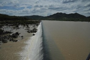
13 | Dong Cam Dam | Hoa Hoi Commune, Phu Hoa District | The dam is 688m long with 2,500 large and small items, has 2 main canals North and South 70km long and a level II canal system distributing water to the intra-field canal network in Tay Hoa, Dong Hoa, Phu Hoa districts and the city. Tuy Hoa | Beautiful scenery, convenient location |
Source [1] and actual survey
(Photo: Nguyen Huu Xuan)
Figure 2.14: Dong Cam DamFigure 2.15: H'Ly Waterfall (Photo: Nguyen Thi Ngan) |
2.2.6. Nature reserve
In Phu Yen territory, there are two NRs: Krong Trai and Bac Deo Ca. Here, the biodiversity is rich, the environment is clean, the climate is cool, which will be ideal conditions for developing ecological tourism and sightseeing. The characteristics of the NRs are as follows:
- Krong Trai Nature Reserve:
Krong Trai Nature Reserve is located in two communes, Krong Trai and Krong Pa, Son Hoa district. The East and Northeast have low mountainous terrain, the rest of the terrain is relatively flat interspersed with some low hills about 150m high.
The reserve covers an area of 22,290 ha, of which 16,005 ha is natural forest (accounting for 72% of the total area); There are 3 main vegetation types: evergreen closed forest (1003 ha), semi-deciduous forest (7111 ha) and deciduous forest (7891 ha) [64]. In addition, there are other habitats such as grasslands, shrublands, and swamps.
Krong Trai has about 236 plant species, 262 terrestrial vertebrate species, including 50 mammal species, 182 bird species, 22 reptile species and 8 amphibian species. There are 09 rare plant species, including 03 species listed in the Vietnam Red Book, and 07 rare animal species, including 02 species listed in the Vietnam Red Book [64].
- Bac Deo Ca Nature Reserve:
The reserve is located in Hoa Xuan Nam and Hoa Tam communes, Dong Hoa district, Phu Yen province. It has a total area of 8,740 ha, a strictly protected area of 2,076.5 ha, a buffer zone of 1,613.7 ha, a core zone of 5,049.8 ha, and a forest area of 3,109.6 ha. The main vegetation type of the reserve is evergreen closed forest. According to statistics from the forestry sector, Bac Deo Ca Nature Reserve is conserving hundreds of species of animals and plants. There are many endemic and rare species (6 rare plant species, including 1 species listed in the Vietnam Red Book; 8 rare animal species, including 1 species listed in the Vietnam Red Book) [1]. The forest has many precious and typical trees such as cho, tram, de, ca na, cam, thi.
Animals include species such as crested geese, red-faced monkeys, black bears, sun bears, pangolins, leopards, porcupines, monkeys, squirrels and many species of birds [65].
2.2.7. Hot mineral springs
Phu Yen has many mineral water sources, some of which have been discovered: Tra O, Triem Duc, Phu Sen, Lac Sanh, these mineral springs are still very pristine. For tourism, hot mineral water spots have potential for resort tourism, medical treatment, and outdoor sightseeing. The natural characteristics of hot mineral spring spots are as follows:
- Tra O mineral spring: Located in Xuan Long commune, Dong Xuan district. The exposed point has coordinates: 13 o 30'29"VB; 109 o 12'50"KĐ. The mineral source was surveyed by C.Madrolle. In 1944, E.Saurin put it on the 1:500,000 geological map (Quy Nhon newspaper). According to the analysis of the Petroleum Research Institute in 1978, Tra O mineral water belongs to the group of silicon-fluorine mineral water, moderately hot; physical properties: clear, odorless; chemical type: water
Sodium bicarbonate and sodium bicarbonate - chloride, very low mineralization; emergent form: water flows from cracks in granite, located about 3m above the spring water level (Long Ba). The total flow is about 1 liter/s [37]. Tra O mineral spring is a medium hot water source, with a temperature of about 55 0 C, the farther from the spring, the cooler the water becomes [1].
- Triem Duc mineral spring: Located in Triem Duc village, Xuan Quang 2 commune, Dong Xuan district. The exposed point has coordinates: 13 o 21'05"VB; 109 o 03'45"KĐ. Triem Duc mineral spring was studied by C.Madrolle, F.Blondel in the years 1926-1931, in 1944 it was put on the geological map 1:500,000 by E.Saurin (Quy Nhon newspaper). The exposed water source is close to the river bank, about 4 m higher than the river surface, including many exposed points. Hot water flows up from
cracks in granite with a total flow of 3-4 l/s [37]. According to analysis by the Pasteur Institute in Nha Trang, Triem Duc mineral water belongs to the group of silicon-fluorine mineral water, very hot, physical properties: clear, odorless, bland taste; chemical properties: sodium bicarbonate water, very low mineralization. Mud and water in the stream can cure some diseases of the heart, joints, skin diseases... With high water temperature, above 70 o C (when the weather is cool, the rising steam can be seen), here you can boil some types of meat and eggs.
- Phu Sen mineral spring: Located in Hoa Dinh Tay commune, Phu Hoa district, coordinates: 13 o 00'23"VB; 109 o 10'00"KĐ. Here, water gushes up in a group of veins in the middle of the rice field, creating a swamp measuring about 20 x 100 m. At the largest vein, people have built 2 wells, the water level rises 0.5 m above the ground and flows out from 2 faucets with a flow rate of 0.3 l/s. In addition, there are some seepage-like exposure points on the edge of Du Tom stream about 100 m from the main exposure point, with a very small flow rate.
According to documents of Le Duc An [61] as well as analysis of Pasteur Institute Nha Trang,