23
In 2015, Vu Quang Manh published a monograph addressing issues of systematics and zoogeographic characteristics of Vietnamese oribatids [144].
Also this year, there were additional studies by Do Thi Hoa in the Mau Son mountain area, Lang Son province [3], Do Thi Duyen in 4 types of soil in Nam Dinh province and Hanoi city [2]. These studies all concluded on the role of using Giap beetles as a biological indicator for soil quality and climate change in the study area. In 2016, there was a study by Pham Thi Lien in the agricultural model
- forestry in Dai Tu district, Thai Nguyen, Northeast Vietnam, the study showed that, among the 4 types of models surveyed, the planted forest model had the highest number of species, average density, richness d and species diversity H', but in terms of uniformity J', the perennial fruit tree model was the highest among all 4 models. The study also concluded that the types of agricultural and forestry models have a certain impact on the soil ecosystem, reflected in the change in the structure of the oribatid cicada community [8].
Maybe you are interested!
-
 Natural, Economic and Social Characteristics of Hanoi and Organizational Structure of People's Court in Hanoi City
 -
 General Assessment of Hanoi's Natural and Socio-Economic Conditions Impacting on the Activities of TNCs.
 -
 Natural, Economic, Political, Cultural - Social Conditions, Law Violations in the Mekong Delta Region Affect Education
 -
 Overview of Natural Conditions, Socio-Economics and Current Land Use Status in Lai Chau City, Lai Chau Province
 -
 Overview of the Economic, Social and Educational Situation of Dak Glong District, Dak Nong Province
In 2020, Vu Quang Manh in the work " Oribatid mites (Acari: Oribatida) of Vietnam - species diversity and distribution characteristics " summarized that the number of taxa of Vietnamese oribatid mites currently recorded 726 species belonging to 245 genera, 90 families and 41 superfamilies [145].
It is noteworthy that in the period from 2008 to present, the Vietnamese oribatid fauna continues to receive increasing attention from scientists around the world, with the number of oribatid research projects in Vietnam increasing significantly:
Among foreign scientists studying oribatids in Vietnam, we must mention Ermilov, Niedbala, Minor (2015), in which Ermilov is a young Russian scientist, but has the largest number of research works in Vietnam. From 2010 - 2015 [95], Ermilov continuously published new species in Vietnam. In about 5 years of research, Ermilov and his colleagues described about 80 new species for science, in 2011 there were 12 works publishing new species, in 2012 there were 9 works, in 2013 there were 8 works, in 2014 there were 9 works and in 2015 there were 6 works. Notably, in 2015, Ermilov published a list of oribatids in Vietnam with a total of 535 species and subspecies up to that time.
24
belonging to 222 genera and 81 recorded genera, of which 194 species are new to science [89]. Ermilov's studies mainly focused on the Eastern and Southwestern regions of Vietnam, some typical areas such as: Dong Nai Biosphere Reserve, Dong Nai Nature and Culture Reserve, Bu Gia Map National Park, mangrove forests, Bi Doup - Nui Ba National Park, Cat Tien National Park, in the Central region there is Phong Nha - Ke Bang National Park. This is a great effort by a foreign scientist, however there are a few notes in Ermilov's research such as the citation of the map of the Socialist Republic of Vietnam completely lacking islands and island regions such as Truong Sa, so it should be reviewed before use.
In 2014, Fernandez and colleagues conducted a study in Hon Chong (Kien Giang) on the Lohmanniidae family with the description of two new species. The author emphasized that this was the first study on the Lohmanniidae family in Hon Chong and that the special thing was that the Bedoslohmannia anneae n. gen., n. sp. had a very special leg shape, so they had a very interesting movement process [71]. In 2015, Fernandez and colleagues continued to conduct a second study in Hon Chong (Kien Giang), describing two new species Papillacarus whitteni sp. nov. (Lohmanniidae family) and Basilobelba maidililae sp. nov. (Basilobelbidae family) [102].
In 2017, Minor et al. continued to study the diversity of oribatid mite communities in the tropical highlands of Bi Doup - Nui Ba National Park, Southern Vietnam. The study showed that the density and abundance of oribatid mite species were affected by both forest type and substrate [122], and the community composition was strongly affected by the substrate.
Thus, the general study of Vietnamese earwigs shows that:
Up to now, the research process of Oribatida in Vietnam has gone through about 50 years, although it was formed in the late 20th century, but in fact this research school has gradually been affirmed and increasingly developed, from the period (1967 - 1986) of building the basis and laying the initial foundation for the research of Oribatida in particular and Microarthropoda in general in Vietnam. To the period (1987
– 2007) formed a specialized research direction on the fauna and ecology of the Arthropoda group in the soil ecosystem, with two dominant groups, Oribatida and Collembola. Through
25
Research and training, has formed a group of experts, including 2 Associate Professors, PhDs and 14 masters in the field. The research area has been expanded to many provinces and localities across the country. Period 2008 - present: the direction of in-depth research on the fauna and ecology of Arthropoda animals in the soil ecosystem is increasingly developing, the large team of researchers with higher qualifications including 1 Professor, PhD, 1 Associate Professor, PhD, 7 PhDs and about 30 masters in the field as of 2015, working in many universities, colleges, research institutes in all regions of the country, the research area is expanded to the North, Central, Central Highlands, and South; the number of research projects is increasing and very diverse, covering many fields such as research on species diversity, research on ecology, the role of biological indicators, etc.
The number of discovered oribatid species has increased every year, the highest in the period from 2008 to present. Period 1967 - 1986: 73 species were recorded (PhD thesis, 1986, Vu Quang Manh). Period 1987 - 2007: about 150 species were recorded (DV Chi, Volume 21: Oribatididae, 2007, Vu Quang Manh). Period 2008 - present: 726 species belonging to 245 genera, 90 families and 41 superfamilies were recorded (Vu Quang Manh, 2020).
The contribution of foreign experts to the research of Vietnamese oribatid fauna has increased strongly, especially in the period 2008 to present. Period 1967 - 1986: there were 6 foreign experts with 4 published works: Balogh and Mahunka (1967), Rajski and Szudrowicz 1974; Golosova (1983, 1984); Jeleva & Vu 1987. Period 1987 - 2007: there were 5 foreign experts with 9 published works: Mahunka (1987, 1988, 1989), Niedbala (1989), Krivolustky
(1991, 1997, 1998), Pavlichenko (1991), Stary (1993). Period 2008 - present: there are 5 foreign experts but there are 51 publications, especially the contribution of Ermilov (2010 - 2015) with 44 research works, Niedbala (2013, 2014),
Fernandez (2014, 2015), Minor (2015, 2017), Miko (2017).
From the sampling map, it is clear that studies on the Vietnamese oribatid fauna are conducted scattered from North to South, but most of them are still concentrated in the Northeast and the Red River Delta, the Northwest is still an area with a small number of studies. Recently, the Eastern and Southwestern regions of Vietnam have received more attention and research interest from foreign scientists.
26
Research orientations in Vietnam, including surveying species diversity, describing and publishing new species, are still the focused orientations, along with expanded research contents on assessing distribution characteristics, oribatid mite community structure, surveying related to environmental fluctuations in different habitats, in soil layers, in seasons... Research on the role of oribatid mites as a bioindicator is also gradually receiving attention, research to determine the possibility of being a vector carrying cysts of oribatid mites, research on the characteristics of animal agents of oribatid mites fauna.
1.3. Research on Oribatid mites in the study area
The research area is located in Moc Chau district, Son La province, in the Northwest region of Vietnam (including 4 provinces: Lai Chau, Dien Bien, Son La, Hoa Binh).
In Son La province, there have been a number of studies conducted by Vu Quang Manh and colleagues to assess the density, species diversity, geo-zoological characteristics and the role of the Microarthopoda group of mites and fleas in the mountainous areas of Northwest Vietnam, during the years 1982, 1984, 1987, and further research was expanded in the years 1988 - 1996, 2000, 2003 - 2006 [11], [17]. The studies were conducted at the top of Pha Luong mountain (1507 m high) in Tan Xuan commune, Xuan Nha nature reserve, Na Hieng village in Xuan Nha commune, Moc Chau district, Son La province. The studies were conducted.
Some scientific works were published during this research period:
Jeleva M., and Vu Quang Manh (1987), published a research work on some groups of lower oribatid mites in Northern Vietnam, giving a list of 11 species of lower oribatid mites belonging to 8 genera, 6 families, of which four species were sampled in Son La city, Northwest Vietnam [106].
Vu Quang Manh (1993) summarized and listed 47 species of oribatids in the mountainous region of Northwest Vietnam, bringing the total number of oribatids known in this area up to that time to 53 species. This result contributed 14 new species to the Vietnamese oribatid fauna [11]. The studies were conducted in four types of habitats: natural forests at the foot of Pha Luong mountain, Na Hieng village, Xuan Nha commune, Moc Chau; secondary and man-made forests in Na Hieng village, Xuan Nha, Moc Chau;
27
grassland and cassava fields in Na Hieng village, Xuan Nha, Moc Chau and shrub and grassland habitats of Son La city. Soil samples were collected in 3 layers: moss layer and plant debris 1m above the ground, leaf litter layer and soil layer (-1) 0 - 10cm. Of the 47 identified species of oribatids, 24 species were collected in the natural forest at the foot of Pha Luong mountain (1450m). 12 species were recorded in secondary and artificial forest habitats, 4 species were recorded in grassland and shrub habitats, 11 species were recorded in cassava fields in Na Hieng village and shrub and grassland habitats of Son La city, Son La province recorded 11 species of oribatids. The results of this study were summarized in the work Fauna of Vietnam - Volume 21 of the Oribatids by author Vu Quang Manh [17], [143], [144].
Thus, up to this point, in Son La province, there have only been some studies in Son La city and some locations in Moc Chau district. In other habitats of the district, there have been no scientific studies on the Oribatida species (Acari: Oribatida).
1.4. Overview of natural and social conditions of the study area
1.4.1. Geographical location, terrain and soil
Geographical location:
Moc Chau is a mountainous, border district located in the southeast of Son La province. The average altitude above sea level is 1,050 m. Geographic coordinates are 20 o 63' north latitude and 104 o 30' - 105 o 7' east longitude, with a common border of 40.6 km long. The east and southeast borders Van Ho district, the west borders Yen Chau district, the south borders Van Ho district and Sop Bau district, Hua Phan province (Lao People's Democratic Republic), the north borders Phu Yen and Bac Yen districts (Da River is the boundary). From Son La city to Moc Chau district, follow National Highway 6, 115 km long [180]. From Hanoi to Moc Chau district, follow National Highway 6, 195 km long.
Terrain:
Moc Chau is a land with karst terrain (limestone mountains), with many undulating mountains and hills, lying next to each other running in the northwest - southeast direction, interspersed with large plateaus are grasslands, basins, ravines,
28
Streams and rivers make Moc Chau's terrain diverse. Moc Chau is classified as a land with a contact position between many geographical systems [7].
The limestone mountains in Moc Chau have an average height of 1,100 m - 1,300 m above sea level, of which Pha Luong peak in the south of the district is the highest mountain, with an altitude of 1,880 m. The plateaus and basins (plains between mountains) create a unique topographic element of Moc Chau land [180], Moc Chau plateau has an average height of 1,050 m.
Soil:
Currently, Moc Chau district has a total natural area of 108,166 hectares. Agricultural land is 84,020.99 hectares, accounting for 77.68% of the total natural area, of which agricultural land is 33,596.96 hectares, accounting for 31.1%; forestry land is 50,303.05 hectares, accounting for 46.5%; aquaculture land is 99.86 hectares, accounting for 0.09%; other agricultural land is 21.12 hectares, accounting for 0.02%. Non-agricultural land is 4,758.15 hectares, accounting for 4.4%, of which residential land is 813.06 hectares, accounting for 0.75%; specialized land is 2,114.20 hectares, accounting for 1.95%; religious and belief land is 2.00 hectares, accounting for 0.002%; cemetery land is 319.25 hectares, accounting for 0.295%; River and stream land and specialized water surface 1,509.55 ha, accounting for 1.396%; other non-agricultural land 0.09 ha. Unused land 19,386.86 ha, accounting for 17.92% of the district's natural area. This is the potential to expand the land fund for agricultural and forestry production as well as partially meet the land needs for specialized purposes.
Thanks to geological and geographical movements, two basic soil types have been created for Moc Chau. Red-brown frealit soil develops on the weathered limestone (mother rock) foundation, i.e. hills and plateaus. This is a good soil with a lot of humus, suitable for dry crops, especially industrial crops such as tea, coffee... and flatlands, large bare hills with low slopes, which are fertile grasslands very favorable for the development of large-scale livestock farming. Ancient alluvial soil, distributed along valleys, basins between mountains or small patches at the foot of mountains. This soil has a thick layer, favorable for irrigation for rice cultivation and fruit tree planting [180]. Therefore, this land has become a residential area, one of the key economic areas of the district and the province.
29
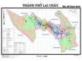
Figure 1.3. Map of Moc Chau District
Source: https://mocchau.sonla.gov.vn/1306/31789/62165/ban-do-hanh-chinh (Scan scale: 1:85 000)
1.4.2. Climate and hydrology
Climate:
Moc Chau's climate is divided into two distinct seasons: the rainy season from April to September, the dry season from October to March of the following year. However, due to its location in the highlands with high altitudes and an open arc terrain to welcome the wind, Moc Chau mountainous area is the place that receives early and is deeply influenced by the northeast monsoon, the wind blowing from Laos, so here there is a subtropical climate element that is most evident in the communes along National Highway 6 and neighboring areas. The climate here is very cool, the average temperature is from 18 o C to 23 o C, the temperature difference between day and night is 8 o C; the average humidity is 85% and it is the place with the lowest evaporation in the province, an average of 572 mm/year. Moc Chau is a district with quite abundant rainfall, the average number of rainy days is 186 days/year, the average annual rainfall is from 1,400 mm/year.
– 1,500 mm and is the district with the highest number of drizzle days in the province, an average of 50 days a year. This is also an area affected by a number of storms and northeast monsoons, so the dry season is quite cold and often has frost, the average number of frost days is 5 days/year. Notably [180], Moc Chau is the district with the highest number of foggy days in the province, an average of over 80 days/year.
Hydrology:
With the above geological structure, Moc Chau is also the meeting place of many rivers and streams. In which, Da River is a large river located in the north of the district, flowing through Tan Hop commune to Quy Huong commune. Sap stream flows through Moc Chau district with a length of 85 km. Together with Quanh stream, Don stream, Giang stream... the total length is up to 247 km, playing an important role in the development of this land.
Currently, the Da River belongs to the largest river system in the Northwest region of our country, with the outstanding features of the large river slope, strong flow, especially in the flood season, so it has the potential to build hydroelectric power. In 1994, the Hoa Binh hydroelectric project was completed, in 2014 the Son La hydroelectric project was completed, providing the largest source of electricity for the whole country, at the same time creating a large Da River reservoir area. Those rivers, streams and lakes not only have the role of regulating water